Loading... Please wait...
Huge range of New Marine electronics for sale , Cheap boat electronics for sale
Categories
 New Products
-
 $799.00
-
 $3,040.00
-
 $380.00
-
 $2,327.00
-
 $2,944.00
Our Newsletter

- Home
- Garmin Marine Electronics
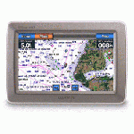
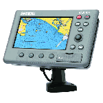
- Garmin Gpsmap 478 Gps Chartplotter W/pre-loaded Marine And Road Maps
Garmin Gpsmap 478 Gps Chartplotter W/pre-loaded Marine And Road Maps


Product Description
Garmin Gpsmap 478 Gps Chartplotter W/pre-loaded Marine And Road Maps
On land or water, you’re ready to go
Go from box to boat to dash with the portable and versatile Garmin GPSMAP 478. This combination color chartplotter and land navigator comes preloaded with U.S. marine charts utilizing elements of the latest BlueChart g2 technology, in addition to detailed street-level mapping. Optional weather and sonar capabilities combined with the ability to conveniently add plug-in data cards, let you easily add more maps and features – making this one incredible GPS navigator for land and sea.
Preloaded and Portable
From curbside to dockside, the GPSMAP 478 has you covered – no downloads or computer required. Its built-in marine charts utilize the latest BlueChart g2 technology and feature coverage for all U.S. coastal areas, including Alaska and Hawaii. Our g2 mapping technology offers a smoother, more fluid presentation on your screen.
For road trips, the 478 along with its freshwater counterpart, the GPSMAP 378, come preloaded with City Navigator NT detailed street maps for North America and include automatic routing with voice guidance along with an industry-leading database with more than six million points of interest – including hotels, restaurants, gas stations, marinas, attractions and more. An included marine mount and automotive kit make it a snap to transfer the unit from boat to car.
Up-to-date Weather
See real-time weather displayed on the 478’s high-resolution 256-color sunlight-readable TFT display with the purchase of the GXM 30 antenna (sold separately) and subscription to XM WX Satellite Weather. View vital weather data, such as NEXRAD radar, storm cells, wind speeds, surface temperatures, forecasts and more than a dozen other weather attributes directly on the unit’s display – so you can spend more time enjoying the water and less time worrying about the weather.
With the GXM 30 antenna, you also have the option of receiving XM Satellite Radio’s 150 plus channels of commercial-free music, sports, news, talk and entertainment programming. Weather and audio options travel with your plotter, whether you’re navigating on land or sea.
Sonar Capability
If fishing’s your game, pair the 478 with the Garmin GSD 21 remote sounder module to add sonar capability. The GSD 21 is Garmin’s “black box” sounder, which offers 4,000 watts of power peak-to-peak (500 watts RMS) in a dual-frequency transducer (purchased separately).
Plug-and-play Additional Mapping
Optional software available on plug-in Garmin data cards, lets you instantly add new maps to your GPSMAP 478 – without connecting to your computer. Easily customize map data for your adventures on land or sea with our optional MapSource cartography. Plug-in the latest BlueChart g2 data cards to add “real picture” aerial photo reference, detailed coastal roads and points of interest. For inland coverage, try the preprogrammed U.S. Inland Lake data cards.
The GPSMAP 478: Loaded and ready for action, right out of the box.
Garmin Gpsmap 478 Gps Chartplotter W/pre-loaded Marine And Road Maps
- Receiver: WAAS-enabled, 12 parallel channel GPS receiver
- Display: 3.8-inch diagonal, 480 x 320 pixel, 256-color TFT screen with adjustable LED backlight
- Unit dimensions: 5.7″W x 3.2″H x 1.9″D
- Waypoints: Stores 3,000 waypoints and 50 reversible routes
- Tracks: 10,000 point automatic track log saves up to 15 tracks
- Battery life: Rechargeable lithium-ion battery offers 4 to 15 hours of use (4 hours with GXM 30 and 15 without GXM 30)
- Water resistant up to IEC 60529 IPX7 standards (submersible in one meter of water for 30 minutes)
- Preloaded with U.S. marine detail charts utilizing g2 technology
- Built-in street navigation with voice prompts, using included cable and speaker
- Accepts the latest (optional) BlueChart g2 data cards
- Add optional GSD 21 for full-feature sonar capability
- Add optional GXM 30 antenna for XM WX Satellite Weather
- Provides tides and built-in celestial information
- NMEA 0183 input and output
- Removable quad helix antenna
- Single knob tilt/swivel mount
Garmin Gpsmap 478 Gps Chartplotter W/pre-loaded Marine And Road Maps
- Garmin GPSMAP 478
- Preloaded with U.S. marine detail maps (g2 technology)
- Preloaded City Navigator NT North America (full coverage)
- Trip & Waypoint Manager
- USB/PC interface cable
- Power/data cable
- Marine mount
- Automotive mount
- Universal friction mount
- 12-volt adapter cable with speaker
- AC charger
- Protective cover
- Owner’s manual
- Quick reference guide


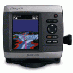
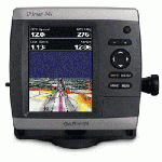
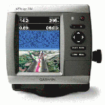
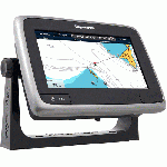
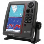
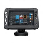
Customers Who Viewed This Product Also Viewed
-
 $180.00
-
 $1,187.00
-
 $1,615.00
-
 $569.00
-
 $541.00
-
 $513.00
-
 $361.00
-
 $589.00
-
 $247.00
-
 $308.00